After 30+ years working with measured surveys of complex buildings, we’ve learned that most “model problems” start before the scanner reaches site. They begin when clients and providers fail to ask or answer the right questions, leaving outcomes undefined.
We so often wrongly sell the deliverables an LOD 300 model, BIM metadata, polished Revit files as if they were the outcome. They are not.
The outcome is solving the core problems that initiated the project in the first place.
When we skip this conversation, projects fail in an expensive way. Success comes from defining outcomes clearly and allowing them to define the work flow rather than the deliverables.
The difference between a scan that reduces risk and one that creates headaches usually comes down to four questions:
1. How will this reduce risk on my project?
If the answer is only about resolution or deliverables, something’s missing. Real value is removing uncertainty early before decisions become costly to change.
2. How much interpretation is built into the model?
Buildings evolve. Capturing reality is simple interpreting complex, altered structures correctly is not.
2. Who is this model actually for?
Design teams, contractors and asset owners need different things. Without a clear user, a model becomes a technical artefact instead of a working tool.
3. What happens after handover?
A good BIM model should keep creating value, supporting maintenance, future works and long-term asset decisions.
Over the coming weeks, we’ll share the six most common questions clients ask once they start looking seriously at 3D scanning and BIM/Revit modelling and what we’ve learned delivering these projects in the real world.
If you’re starting a project and want a partner who understands the pitfalls as well as the process, we’re always happy to talk.
Why scan-to-BIM projects disappoint — and what actually fixes it
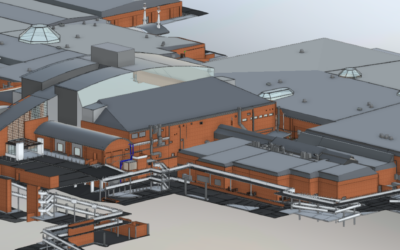
At 5D Geo, we take our name from the five dimensions of BIM — 3D geometry, time and cost. It is a deliberate statement of intent. A 3D model of existing conditions is only the starting point. What matters is what you do with it, and whether it was built accurately...


0 Comments