
Laser scanning lets us capture 100 million spatial coordinates in hours. Brilliant technology. But I’m seeing too many projects where we just stop there.

The client gets 5GB of point cloud data and we say “Here’s everything – you work out what matters.” Is that actually service, or are we just industrialising data collection?
To understand why this matters, consider what we used to do. In the past we would survey with a total station survey and deliver ±3mm accuracy across 200-500 carefully selected points. Wall positions, floor levels, column location. A process that is both efficient and disciplined. But that survey only answers what was asked for.
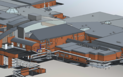
On a modern refurbishment with dense MEP services, the questions you need during coordination weren’t always predictable when the client specified the survey and yes, Laser scanning captures better raw data – but we’re failing to add professional value to that comprehensive and more useful dataset.
There is no doubt that comprehensive 3D laser scanning gives us better source material showing the complete geometry, nothing is missed. But that should make our judgment more valuable, not less.
The question: are we using laser scanning to deliver better judgment, or to avoid making judgments at all?
Increasingly, we see scan-to-BIM delivery that’s basically semi-automated extraction with minimal oversight. The scanning might be sufficient, but the modeling is done by operators with no geospatial training – they don’t understand scan registration tolerances, can’t verify point cloud accuracy, and don’t know when coordinate systems are not aligning properly. The models look functional, but the dimensional reliability needed for coordination is not present. You get a model that looks comprehensive but has unknown positional accuracy – which defeats the entire point of using scan data for coordination.
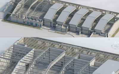
The client gets walls, ceilings, MEP services, furniture, cable trays being removed next month, all modeled to the same LOD because nobody made decisions about what actually needs documenting for coordination.
That’s not service. That’s data dumping with expensive equipment.
What we should actually do is firstly acknowledge that the value isn’t in the 3D scan capture, scanners do that. It’s found in:
- Asking coordination requirements before you start.
- Knowing which zones need detail versus simple volumes
- Identifying what’s permanent versus temporary
- Choosing the right LOD for different elements
- Delivering models that actually help coordination
A 5GB point cloud needs judgment to become a 1GB federated model that actually helps. That judgment is the service.
Let’s start by ensuring that when we hand over our model, the design team immediately knows:
- What’s been documented and what hasn’t?
- What level of detail can they rely on?
- Which elements matter for coordination versus just context?
- What spatial conflicts have you already identified?
Or do they get a massive point cloud attached to a machine learning generated model and have to work all that out themselves?
A big part of this is commercial pressure. Clients see laser scanning as expensive, so there’s pressure to “just scan it all” and minimise processing costs. Quick extraction, minimal interpretation, hand it over.
But the scan is the cheap part. The judgment to turn 100 million points into coordination-ready information is where the value is. And where we should be charging properly for skilled work.
Are we undervaluing our expertise because clients think they’re paying for the scanner?
This is hard. Making good decisions requires:
- Understanding design intent (we’re surveyors, not designers)
- Knowing the construction sequence (often not sorted when we’re brought in)
- Predicting coordination needs (requirements change during design)
So it’s tempting to “model everything and let the design team decide.” But that’s dodging our responsibility.
Laser scanning technology is brilliant. But technology doesn’t fulfill our duty – judgment does.
Our job isn’t to capture everything. It’s to understand what matters, document it properly, and deliver information that supports decision-making.
Are we doing that? Or are we confusing having all the data with providing useful information?
https://www.linkedin.com/pulse/we-confusing-data-collection-professional-service-5d-geo-c7snf

0 Comments