5DGeo Remarkable Geospatial Insights
  • Home
  • Services
    • Aerial and Drone Mapping
    • Laser Scanning & REVIT Based 3D Models
    • Detailed Site Plans
    • Property Boundary Surveys, Subdivisions & Consolidations
    • Sectional Title Plans & Survey
    • Prospecting, Mineral & Mining Rights Plans
    • Engineering and Construction Surveying
    • Underground Services Detection
  • About
  • Contact
  • Blog
  • 082 773 4868
Select Page
Point Clouds –  The Future of Geospatial Mapping

Point Clouds – The Future of Geospatial Mapping

by Chris Kirchhoff | Jun 5, 2023 | Laser Scanning and Revit Based 3D Models

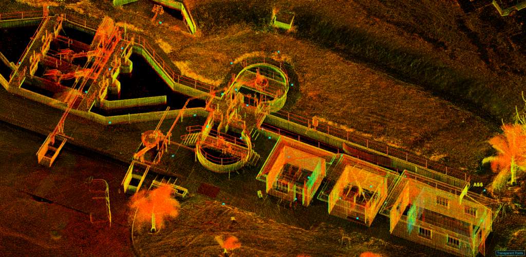
Today, we’re turning our spotlight on a remarkable innovation that’s transforming the way we understand and interact with the world around us: 3D point clouds, generated by something called terrestrial laser scanning. It may sound like something out of a science...

Industry leaders in 3D Scanning, Revit modelling and Land surveying.

© 2023 5DGeo Pty Ltd.

PAGE LINKS

Home
Services

  • Aerial and Drone Mapping
  • Laser Scanning & REVIT Based 3D Models
  • Detailed Site Plans
  • Property Boundary Surveys, Subdivisions & Consolidations
  • Sectional Title Plans & Survey
  • Prospecting, Mineral & Mining Rights Plans
  • Engineering and Construction Surveying
  • Underground Services Detection

About
Contact
Blog

JOIN OUR NEWSLETTER
Sign up here and every 14 days receive - Industry best practice suggestions, Autodesk tips and learn about digital twins.

Success!

Subscribe

You can unsubscribe at any time. For more details, review our Privacy Policy.

Website by Stephen Strydom Digital Marketing.