5DGeo Remarkable Geospatial Insights
  • Home
  • Services
    • Aerial and Drone Mapping
    • Laser Scanning & REVIT Based 3D Models
    • Detailed Site Plans
    • Property Boundary Surveys, Subdivisions & Consolidations
    • Sectional Title Plans & Survey
    • Prospecting, Mineral & Mining Rights Plans
    • Engineering and Construction Surveying
    • Underground Services Detection
  • About
  • Contact
  • Blog
  • 082 773 4868
Select Page
The End of the 2D Guessing Game: Why Point Clouds are a Professional Necessity

The End of the 2D Guessing Game: Why Point Clouds are a Professional Necessity

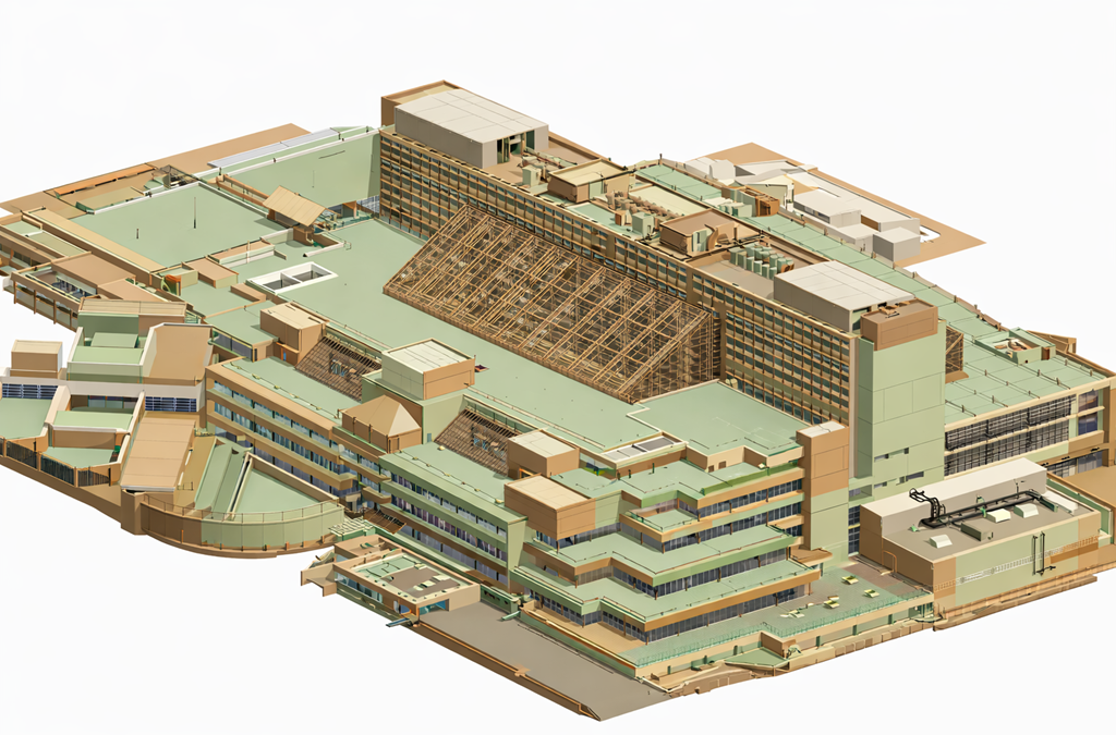
by Chris Kirchhoff | Feb 2, 2026 | Laser Scanning and Revit Based 3D Models

In the modern AEC (Architecture, Engineering, and Construction) landscape, we have crossed an important  threshold. Project complexity and compressed programmes have reached a point where selective spatial project information is no longer a starting position. It is a...
Laser Scanning and 3D Revit Models for Building Refurbishment

Laser Scanning and 3D Revit Models for Building Refurbishment

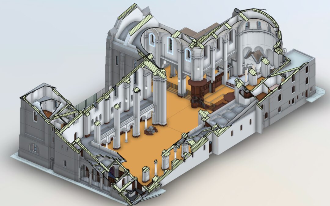
by Chris Kirchhoff | Jan 22, 2026 | Revit

Refurbishing existing buildings rarely starts with reliable information. In South Africa, original as-built drawings are often missing, outdated, or disconnected from what actually exists on site. Alterations accumulate over decades, undocumented and unverified, until...
Reality capture is becoming standard  but assuming all 3D scans are the same can be an expensive mistake.

Reality capture is becoming standard but assuming all 3D scans are the same can be an expensive mistake.

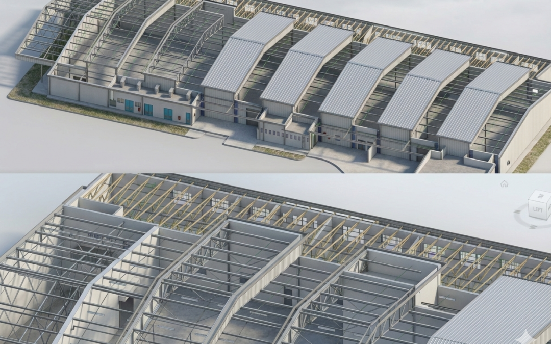
by Chris Kirchhoff | Jan 15, 2026 | Laser Scanning and Revit Based 3D Models

After 30+ years working with measured surveys of complex buildings, we’ve learned that most “model problems” start before the scanner reaches site. They begin when clients and providers fail to ask or answer the right questions, leaving outcomes undefined. We so often...

Industry leaders in 3D Scanning, Revit modelling and Land surveying.

© 2023 5DGeo Pty Ltd.

PAGE LINKS

Home
Services

  • Aerial and Drone Mapping
  • Laser Scanning & REVIT Based 3D Models
  • Detailed Site Plans
  • Property Boundary Surveys, Subdivisions & Consolidations
  • Sectional Title Plans & Survey
  • Prospecting, Mineral & Mining Rights Plans
  • Engineering and Construction Surveying
  • Underground Services Detection

About
Contact
Blog

JOIN OUR NEWSLETTER
Sign up here and every 14 days receive - Industry best practice suggestions, Autodesk tips and learn about digital twins.

Success!

Subscribe

You can unsubscribe at any time. For more details, review our Privacy Policy.

Website by Stephen Strydom Digital Marketing.