by Chris Kirchhoff | Jan 21, 2026 | PointClouds
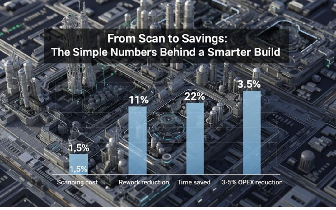
The question isn’t “why aren’t we investing 1% in 3d scanning ”—it’s “how much is rework costing you now?” Our clients use verified as-builts to drive speed, accuracy, and confidence across the entire project. It’s not the future of delivery—it’s already the...
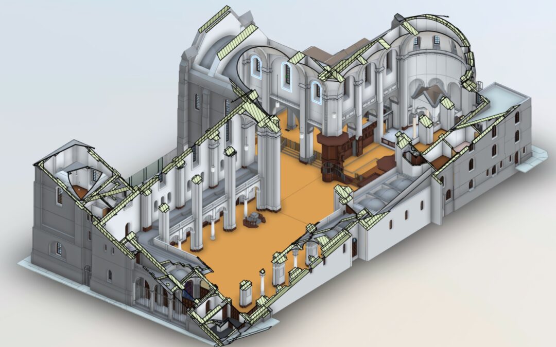
by Chris Kirchhoff | Jan 15, 2026 | Laser Scanning and Revit Based 3D Models
After 30+ years working with measured surveys of complex buildings, we’ve learned that most “model problems” start before the scanner reaches site. They begin when clients and providers fail to ask or answer the right questions, leaving outcomes undefined. We so often...
by Chris Kirchhoff | Aug 28, 2023 | Land Survey
Dive into the world of Land Surveyors, the unsung heroes of infrastructure development. Discover how their precision, risk mitigation, and regulatory compliance expertise drive project success and sustainable development. These experts provide accurate geospatial data...
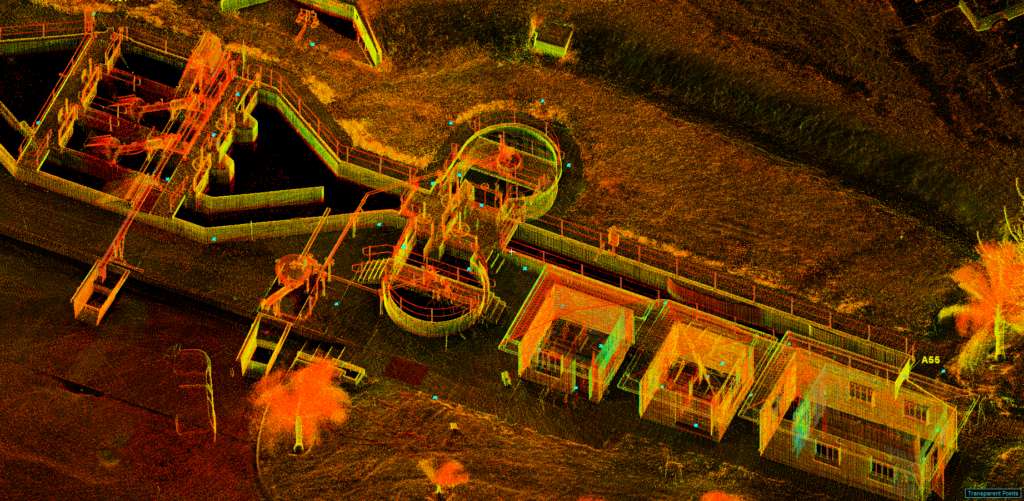
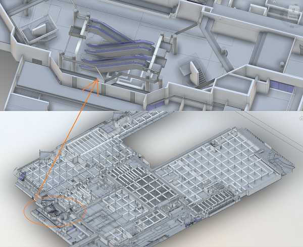
by Chris Kirchhoff | Jun 5, 2023 | Laser Scanning and Revit Based 3D Models
Today, we’re turning our spotlight on a remarkable innovation that’s transforming the way we understand and interact with the world around us: 3D point clouds, generated by something called terrestrial laser scanning. It may sound like something out of a science...
by Chris Kirchhoff | May 24, 2023 | Laser Scanning and Revit Based 3D Models
When it comes to refurbishing existing buildings, accurate data and efficient workflows are crucial for minimizing risks and maximizing cost and time savings. Terrestrial laser scanning, combined with 3D Revit models, is transforming the way architects, engineers, and...