News
Why scan-to-BIM projects disappoint — and what actually fixes it
At 5D Geo, we take our name from the five dimensions of BIM — 3D geometry, time and cost. It is a deliberate statement of intent. A 3D model of existing conditions is only the starting point. What matters is what you do with it, and whether it was built accurately...

Are We Confusing Data Collection With Professional Service?
Laser scanning lets us capture 100 million spatial coordinates in hours. Brilliant technology. But I'm seeing too many projects where we just stop there. The client gets 5GB of point cloud data and we say "Here's everything - you work out what matters." Is that...
The Technology That Lets You Test a R50-Million Project Before Breaking Ground
First published in Imesa Magazine Imagine Fortnite™ meets Minecraft™ meets the real-world city you live and work in – what a computer game that would be. Imagine working in a data rich 5D onscreen world that updates in real time and in which you can play "what if"...
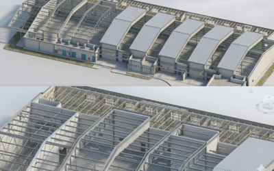
The End of the 2D Guessing Game: Why Point Clouds are a Professional Necessity
Discover why leading AEC professionals are moving from selective 2D surveys to comprehensive point clouds to eliminate “compensatory labor” and manage project risk earlier.
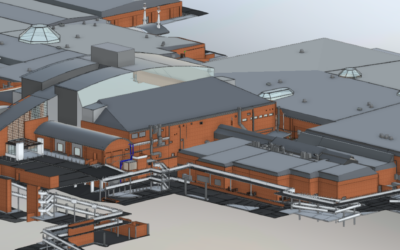
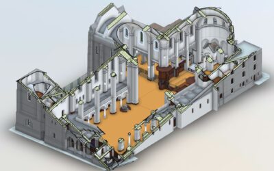
Laser Scanning and 3D Revit Models for Building Refurbishment
Discover how terrestrial laser scanning and 3D Revit models reduce risk, save time, and cut costs in building refurbishment projects.
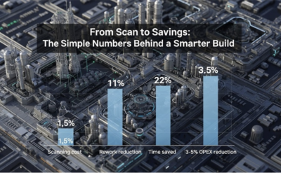
Why investing 1% Upfront in Laser Scanning Pays Off – What High-Fidelity point clouds and Reality Models Actually Deliver.
The question isn’t “why aren't we investing 1% in 3d scanning ”—it’s “how much is rework costing you now?” Our clients use verified as-builts to drive speed, accuracy, and confidence across the entire project. It’s not the future of delivery—it’s already the standard....
Reality capture is becoming standard but assuming all 3D scans are the same can be an expensive mistake.
Reality capture has become standard practice, but assuming all 3D scans deliver the same value can lead to costly mistakes. With over 30 years of experience in measured surveys of complex buildings, we’ve seen that most problems arise long before scanning begins — when outcomes aren’t clearly defined. This article explores the four critical questions that separate scans that reduce risk from models that create uncertainty.

Why Land Surveyors are the Unsung Heroes of Infrastructure Development
Dive into the world of Land Surveyors, the unsung heroes of infrastructure development. Discover how their precision, risk mitigation, and regulatory compliance expertise drive project success and sustainable development. These experts provide accurate geospatial data...
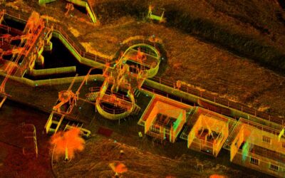
Point Clouds – The Future of Geospatial Mapping
Today, we’re turning our spotlight on a remarkable innovation that’s transforming the way we understand and interact with the world around us: 3D point clouds, generated by something called terrestrial laser scanning. It may sound like something out of a science...